Initiated by: Marjolijn Dijkman as part of the WaterLANDS Artistic Engagement Residency
Since 2023: Individual Research
Turbid Tides is developed within the framework of WaterLANDS (2023–2026), an EU Horizon-funded project in which six artists each reflect on one of six ecological restoration sites across Europe. Marjolijn Dijkman’s contribution focuses on the Ems-Dollard estuary, the largest remaining open connection to the Wadden Sea, on the Dutch-German border, which forms both the site and the subject of the research.
Turbid Tides explores the parallels between rising siltation in the estuary and the expanding influence of computational thinking, with silt and data as its twin protagonists. The research traces a series of paradigm shifts across this particular landscape over time: from the animistic worldviews of pre-Christian mound dwellers living in a tidal landscape, to the Cartesian dualism that shaped reclamation projects, to Freud’s psychoanalytic reading of Dutch land reclamation, and on to current transformations in Western thought about sentience, intelligence, and agency. The project will result in a series of artworks and a publication exploring shifts in how we understand our place in a more-than-human world.
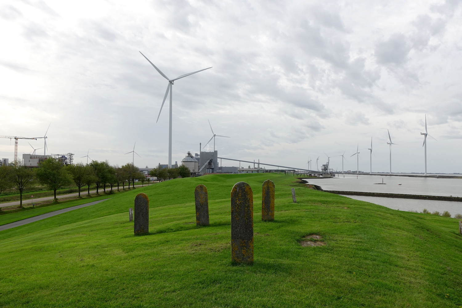
The Ems-Dollard estuary is depleted of life due to siltation driven by a web of interacting factors: dredging, land reclamation, soil subsidence from gas extraction and peat oxidation, sea-level rise, and water management infrastructure, including the Afsluitdijk. Engineers are now experimenting with removing sediment from the estuary into a newly created intertidal area and onto subsided reclaimed land. Ecological restoration here is not only a technical intervention but a philosophical one, an invitation to reconsider the dominant European worldview that divided nature from culture to enable economic exploitation, and to imagine more reciprocal ways of inhabiting shared landscapes.
As Australian philosopher Roman Krznaric argues in The Good Ancestor, the rich history of dike construction and maintenance in the Netherlands exemplifies long-term thinking and intergenerational care, all of which are essential to any genuine restoration of the coastal zone and its inhabitants. Coastal restoration projects require not only technical solutions but a fundamental shift in how we relate to our environment, one that is slowly emerging around the Ems-Dollard, even as economic priorities and water safety demands continue to set the pace and direction of the work.
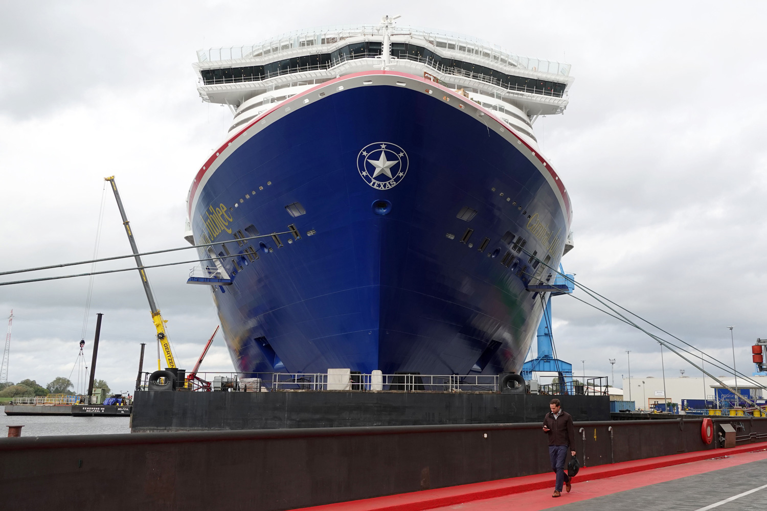
The computational tradition in Dutch water management runs deep. In the 17th century, Descartes introduced the Cartesian grid, imposing geometric order on reclaimed land. This tradition continued through Hendrick Lorentz’s numerical tidal predictions for the Afsluitdijk, the hydrological analogies developed by Rijkswaterstaat, and the adoption of early computers in the 1950s at Amsterdam’s Centre for Mathematics. Today, it continues to evolve with the integration of machine learning, remote sensing, and LiveDikes around the estuary, producing what might be called a cyber-polder landscape. This fusion of the computational and the more-than-human is epitomized by the Google data center (Europe4), whose cooling water, maintained at a steady 23°C, flows into the tidal ecosystem, subtly warming and altering its balance.
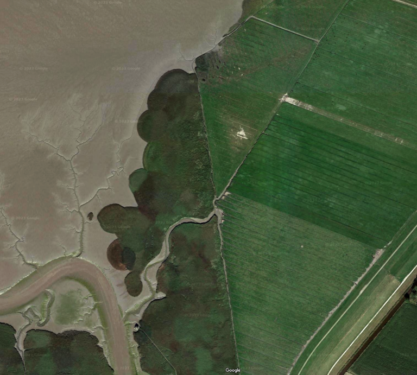
Alongside the estuary, an ambitious wetland restoration is underway: the Twin Dyke, an inland tidal basin where turbid waters flow through a controlled breach, gradually settling into a regenerating saltmarsh. This restoration site is physically connected to the Google data center via a pipeline that carries the facility’s cooling water, which is heated by data flows arriving through marine internet cables, into the estuary. That water now enters adjacent to the dyke’s opening, where it may seep back into the tidal salt marsh, creating an unexpected feedback loop between digital expansion and ecological renewal.
Digital Northsea, Data Delta,
Tidal Computations, Subsea Clouds,
Bit streams, Turbidity Currents
Sediment Connectivity, Submarine Networks,
Smart Dikes, Digital breaches,
Silt Management, Data swamps.
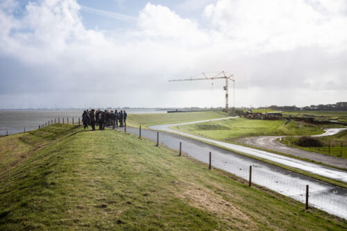
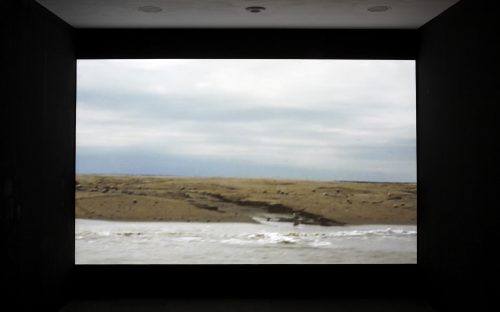
 Documentation of the first walk De Waker (The Watcher), October 2024, photo: Wim Dijkman
Waker Slaper Dromer (Watcher, Sleeper, Dreamer)
‘Waker, Slaper, Dromer’ is a series of three walks named after the poetic names and functions of dike systems in the Netherlands. Here, the ‘watcher’ first protects against the outside water, and the inland ‘sleeper’ catches any breach. Behind this sleeper sometimes lies another ‘dreamer.’
These events connect artistic research, dike construction, ecology, philosophy, and regional history, offering an in-depth look at the landscape through contributions from various experts, each with their unique and local knowledge. These walks will be organized from 2024 to 2026 as part of Dijkman’s WaterLANDS artist residency.
See for more information: www.wakerslaperdromer.nl (Dutch only)
The WaterLANDS project is led by University College Dublin, Ireland and brings together 32 organisations from research, industry, government and non-profit sectors in 14 European countries.
The artists part of WaterLANDS working on 6 different sites are: Maria Nalbantova (Bulgaria), Elo Liiv (Estonia), Christine Mackey (Ireland), Claudio Beorchia (Italy), Marjolijn Dijkman (Netherlands), and Laura Harrington and Fiona MacDonald(Feral Practice) (United Kingdom).
More information: WaterLANDS Artistic Engagement Residency & WaterLANDS